Wild Virginia’s Fight to Help Wildlife Move Safely
By Katie Keller
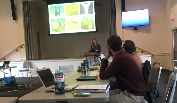
A few weeks ago, Wild Virginia and partners of the Virginia Safe Wildlife Corridors Collaborative (VSWCC) met for the quarterly update. This group develops and implements projects intended to protect people and wildlife by reducing animal-vehicle conflicts and improving safe wildlife passage. They do this by working together to identify and implement innovative solutions to address human safety, wildlife conservation, and habitat connectivity concerns. VSWCC believes in taking a multidisciplinary and multi-stakeholder approach to solving complex transportation and ecological problems along Virginia roads.
First, we heard from Jenny Oren, Policy Intern at the Wildlands Network, about the Wildlife Corridor Initiatives they are currently leading. Their mission is to reconnect, restore and rewild North America, leading initiatives in road ecology, policy, and advocacy. Their focus is on large landscape connectivity in their Eastern, Pacific, and Western Wildways. Habitat connectivity is fragmented by roads and highways, and Jenny states that “I-95 and I-64 are slicing our state, but the road-barrier situation is much better in the western part of Virginia, currently.” In the Eastern Wildway, from Florida to Quebec, Wildlands Network currently has road ecology studies underway in the I-40 Pigeon River Gorge area of TN/NC and at a pair of bridges in Durham, NC in the central Piedmont.
The second speaker was Blair Smyth from The Nature Conservancy (TNC), who spoke about resilient and connected network mapping. Before starting with TNC, Smyth led a black bear research project that included researching their habitats, tracking their movement, and placing orphaned cubs with new mothers.
TNC’s main priorities are to tackle climate change, protect land & water, provide food & water sustainably, and build healthy cities. As the Allegheny Highlands Director, Blair helps lead the largest fire-effects monitoring program in the Appalachians. He showed us the biodiversity hotspots in our region, along with data on temperature increases, climate resiliency, microclimates, and the connectedness of resilient sites.
Bill McShea with the Smithsonian Conservation Biology Institute (SCBI) presented on deer-vehicle collision research and camera trapping in corridors with eMammal, a data management system for these types of projects. This cyber-tool is also helpful to citizen scientists who can aid in photo collection. This system is immensely helpful in tracking deer-vehicle collisions, along with data he’s collected from private landowner research, public land hunting research, and deer-vehicle collisions from VDOT.
We also heard from Jared Stabach on the Movement of Life Initiative. This project at SCBI aims to advance the understanding of how all living things, big and small, move across changing land and seascapes to better sustain a biodiverse planet. SCBI is also working on connectivity studies internationally, using a new rapid assessment corridor mapping tool, google earth engine, (a cloud of satellite and GIS data).
Tom Akre closed the first round of topics with an overview of his wood turtle research. The climate is changing their landscape, and in turn, decreasing safe mobility. For example, Tom found that ‘females have a larger home range over males, which causes them to come in contact with road crossings more often.’ His points on improved tracking with GPS transmitters and a novel movement estimation method clearly demonstrated implications for road mortality.
The afternoon offered interesting discussions among the working groups where they reported on their progress over the last few months.
Matthias Leu is working on hotspot mapping for deer and black bear. They are collecting this data through many facets and hoping to create a visual of wildlife collision high-density areas.
Bridget Donaldson, who was integral to implementing the fencing along 64 to funnel wildlife through current underpasses, updated the group on discussions in Rockbridge County to implement the same measure on I-81 at the Buffalo Creek bridge underpass. The Rockbridge Area Conservation Council is using the findings on I-64 to encourage the Rockbridge Area Board of Supervisors to look into applying for funding to add fencing to the underpass, which is situated along an identified wildlife corridor across the interstate.
The Critter Committee, managed by Misty Boos, works on sampling in the tidewater region along a four-lane highway, where many of the tiny critters don’t stand a chance crossing road. There is no data on wildlife mortality of box turtles and salamanders in this area, so the group is working to develop a proposal and request funding after sampling.
We closed the session with an exciting legislative update. The Virginia Wildlife Corridor and Safety Act was introduced and referred to the Committee on Agriculture, Conservation and Natural Resources on January 16th. The Plan will identify wildlife corridors, defined as areas connecting fragmented wildlife habitats that are separated by human activities or infrastructure, and recommend wildlife crossing projects intended to promote driver safety and wildlife connectivity.